Dangerous storm brings flood warnings, possible tornado to Southern California
The strongest wave of a powerful winter storm reached Southern California overnight, bringing flash flood warnings, dropping snow levels and a possible tornado.
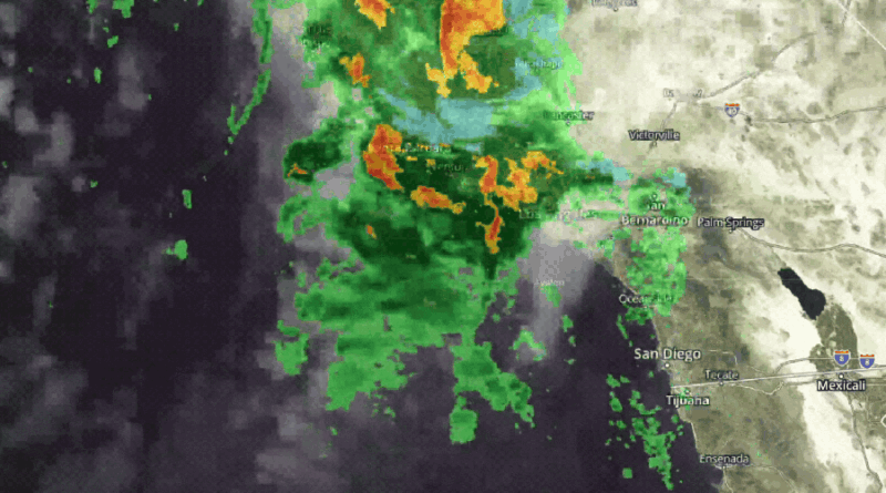
“Storms will likely produce bursts of very heavy rain, along with small hail, gusty winds, and possibly even a waterspout or small tornado are all possible through the day,” the National Weather Service (NWS) said in its forecast Thursday.
In Pico Rivera, a viewer sent images of what was described as a tornado that hit around 3:15 a.m. “There are big pine trees that have been uprooted and landed on cars. There is downed power lines and a water main break and flooding the street,” the viewer on the 9500 block of Glen Cannon Street said.
KTLA is checking with the NWS to see if a tornado did indeed touch down but officials have not confirmed.


Rain rates expected to reach nearly 1 inch per hour at times prompted an early flash flood warning for the Airport Fire burn scar area in Orange County early Thursday morning.
Flood advisories are also in place for Thursday morning for much of Southern California, according to the NWS.
The storm is expected to bring about an inch and a half of rain to the Southland by the time the front moves out later Thursday morning. Roughly three inches should fall in the foothill and mountain areas of Los Angeles County.
Unsettled weather will continue into the afternoon with periodic showers and a chance of thunderstorms continuing “but with some sunny breaks as well,” the NWS said.

Thunderstorms could bring heavy downpours, prompting officials to warn of “at least minor debris flows, roadway and urban flooding, and rockslides.”
Snow levels could bottom out as low as 2,500 feet, with the Grapevine possibly seeing an inch of accumulating snow on the 5 Freeway.
Mountain areas above 6,000 feet should see between one and two feet of snow.
The storm is also bringing gusty winds between 45 and 65 mph, with the most powerful gusts in the mountains. “Isolated downed trees and power outages are possible,” the NWS said.
The region will see a brief lull in the action Thursday night into Friday but another system will move in and bring another quarter of an inch of rain south of Point Conception, according to the NWS.