Considerable precipitation, high winds on the way to Southern California: Here’s when
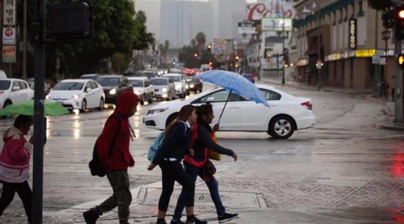
As more rain and high winds make their way into Southern California, forecasters are continuing to increase their precipitation predictions.
The storm system, described as “significant” by the National Weather Service, will bring rain, high-elevation snow and gusty winds to the region, but according to NWS, there is “not much to talk about” on Tuesday as far as storm activity.
“Aside from morning clouds, skies will be partly cloudy at worst,” the weather service said in their area forecast discussion issued early Tuesday morning. “[It will be] another day with below-normal high temperatures.”
When the rain does come, it will be widespread and intense; up to an inch of rain could end up falling per hour on Thursday in some spots. Between three and six inches could fall in mountain communities when all is said and done, while other, lower elevated areas will likely see one-and-a-half to three inches.
Thursday is when rainfall rates will peak; however, some of SoCal will see precipitation starting Wednesday.
“On Wednesday, a slug of moisture with weak dynamics will race out ahead of the [other] storm and move over Southern California, [but] due to the northwest trajectory of this moisture, it will bring more rain to the Central Coast rather than south of Point Concepcion,” NWS said. “There may be a little in-between system, [but] the main storm will move into the area early Thursday morning as an atmospheric river over the middle of the state and morph into a more classic winter storm with a warm and cold front.”

Although the risk for thunderstorms remains relatively low (five to ten percent, according to NWS) there is a moderate risk for “significant” flooding and burn scar debris flows in areas recently affected by wildfires.
There is also a “high risk” for urban flooding of some roads and parking lots, the National Weather Service advised and a Flash Flood Watch will go into effect in and around burn scar areas in much of L.A. and Ventura counties on Thursday.
Those residing at higher elevations will not be spared from the storm, as snow is expected to fall around 6,000 feet and above, with the most intense snowfall coming on Thursday.
“Heavy, wet snow is a concern as low as around 6,000 feet at times with the heaviest totals — 10 to over 20 inches — expected above 7,500 feet in elevation,” NWS said. “These snow amounts combined with the high probability of strong winds will likely result in a Winter Storm Warning for the highest elevations.”
High winds are also set to make their way into the region, with peak gusts of 60 miles per hour forecast in mountain and desert communities. Elsewhere, sustained winds of 20 to 40 miles per hour are expected.
Day-to-day temperatures are not expected to change much as the latest storm system makes its way through Southern California.
By the weekend, this round of storms is forecast to have moved out of the area, leaving behind only cloudy skies.